Low-Level Turbulence: Inversion Layers, Thermals and Microbursts
Low-level turbulence is triggered by weather phenomena that develops close to the ground: inversion layers, thermal plumes and microbursts. Takeoff and landing are already challenging for pilots, so these phenomena add an extra layer of complexity and, in some cases, risk.
Before dealing with the turbulence, we should cover a few basics about atmospheric physics. For quick readers, you can jump directly to the sections titled with “turbulence”.
Tropospheric stability
In physics, it's well known that hot air rises due to its lower density than colder air. However, the troposphere (the lowest layer of the atmosphere) shows a completely different behavior: it gets colder as we go up in altitude, about 5 oC per kilometer. We have all experienced the colder air at the top of a mountain.
Why does this happen?
The reason for this is that the Earth's surface absorbs about twice more sun energy than the gases in the atmosphere. As a result, the temperature on the surface is about 70 oC warmer than at the top of the troposphere.
But this poses another question: if physics say that hot air should rise, does this mean that the troposphere is in an unstable configuration where hot air is constantly trying to climb up and reverse the configuration of cold sky and hot surface?
To some extent, yes. Hot air rises constantly, forming clouds, thunderstorms and jet-streams; and all of these represent instabilities in the atmosphere. However, when looking at the troposphere as a whole, it's in a stable configuration. That is, it will never reach a point when the all the hot air is “finally” at the top.
The reason for the stability is due to a well known factor: gravity. Air close to the ground is pushed down by the air on the top, and this pressure force is just enough to maintain the cold to hot temperature gradient that we see.
Inversion layers
The configuration of hot air on the surface and cold air above is what we can call the “standard” atmosphere. But it's also very common to find inverted layers where hot air sits at the top, and cold air below. If the troposphere is stable, inversion layers are even more stable, since they have both pressure and buoyancy working to keep them that way.
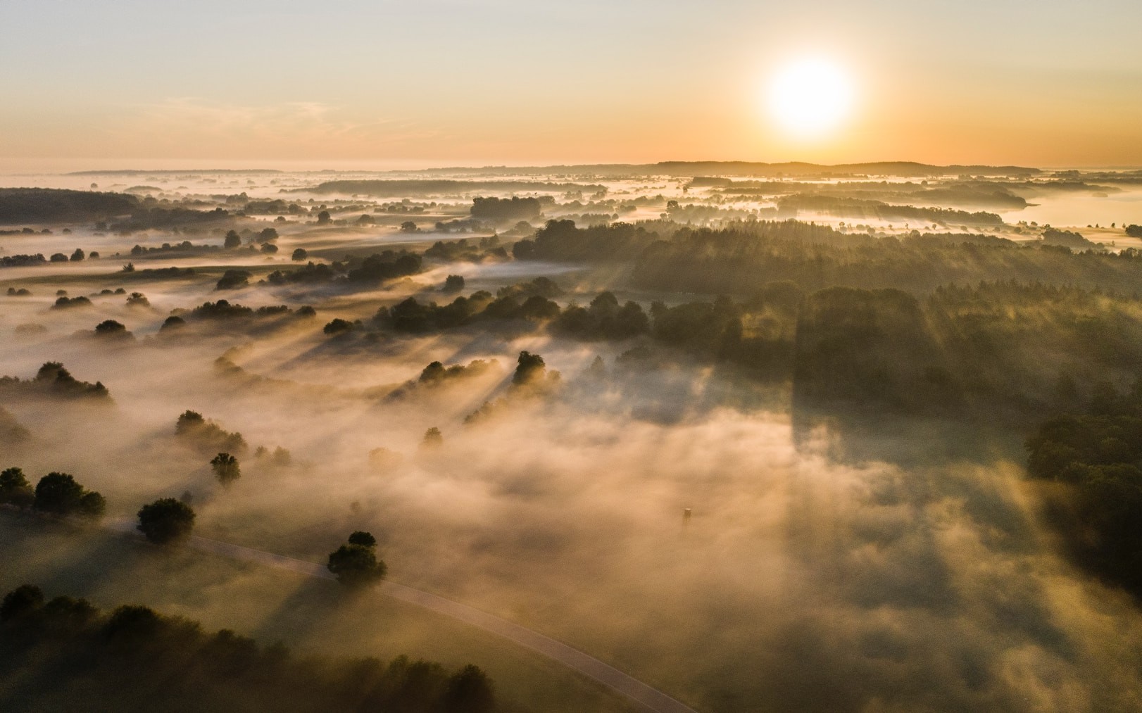
Radiational inversions: Morning fog is a common sign of an inversion layer. During the night, the surface is no longer heated up by the sun, and it begins to cool as it radiates heat to space. As a result, the surface becomes cooler that then air above it, creating a very stable layer that will not allow the morning flog or clouds to be released upwards. It works pretty much like a lid, blocking any upward flow. However, soon after the sun shines, the surface heats up and the inverted layer disappears.
Subsidence inversions: Inversion layers can also be formed when high pressure systems push air down, preventing hot air from being released upwards. In this cases, foggy conditions can last for days rather than disappearing overnight. Downwards air motions can also develop in the absence of high pressure systems; for example, over valleys, since air flowing over a mountain tends to bounce down on the downstream side.
There are other types of inversion layers, and there can be several inversion layers sitting on top of each other at the same time, but the idea is already outlined with these examples. Inversion layers are in fact very closely monitored to predict pollution levels in cities: if a lid sits on top, all the harmful gases will be kept in the city rather than carried away by the wind.
Inversion layer turbulence

Now we know that inversion layers are layers where temperature increases with altitude that act like a lid over the area that they sit on.
The main risk for aviation is that, since inversion layers separate the air above and below, pilots can experience a sudden change of wind speed when crossing them. On top of that, differences in wind speed lead to turbulence, higher as the wind speed differences increase.
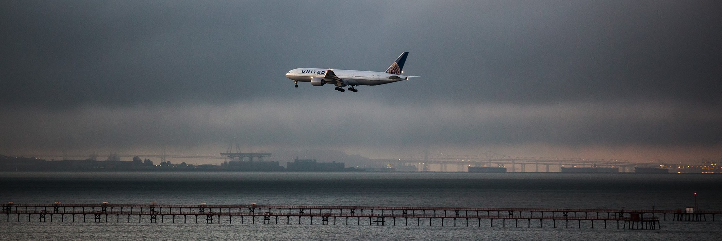
Inversion layers tend to develop close to the ground, reaching altitudes between a few hundred meters and 4000 m for radiational and subsidence inversions, respectively. As a result, they tend to be a problem for takeoff and landing. Even when the turbulence happens to be weak, the sudden change in wind speed can modify the course of landing, causing the pilot reach the runway later or earlier than planned. In this case, landing is usually aborted, and the pilot will climb to make another try later on.
Thermal turbulence

Thermals are upward currents of hot air that rise when the surface warms. Hot air rising is actually happening constantly, but barren surfaces such as deserts tend to form stronger currents since they develop larger temperature differences between the ground and the air. Strong upward currents of water vapor are also common, specially over the Equator, and these usually develop into thunderstorm clouds.
Thermal plumes carry turbulence, but they induce even stronger turbulence to the surrounding air when this one tries to go around them. This is because they are "seen" as obstacles by the surrounding air, and this generates similar swirling flows as those in mountain wave turbulence.
The diameter of the thermal plumes can range between 50-1000 m, and their speed between 3-10 km/h. They are not visible with the naked eye, but birds are particularly good at spotting them. NOAA produces a Soaring Forecast to predict thermals for gliders to enjoy, but these are generally not used in aviation.
The hot air does not rise indefinitely. Sometimes it mixes with the cold air above and looses its upwards momentum, others it can hit an inversion layer and bounce back down as a downdraft, which are also dangerous for aviation.
Microbursts
Microbursts are formed by thunderstorm clouds, whose turbulence we covered in a specific article.
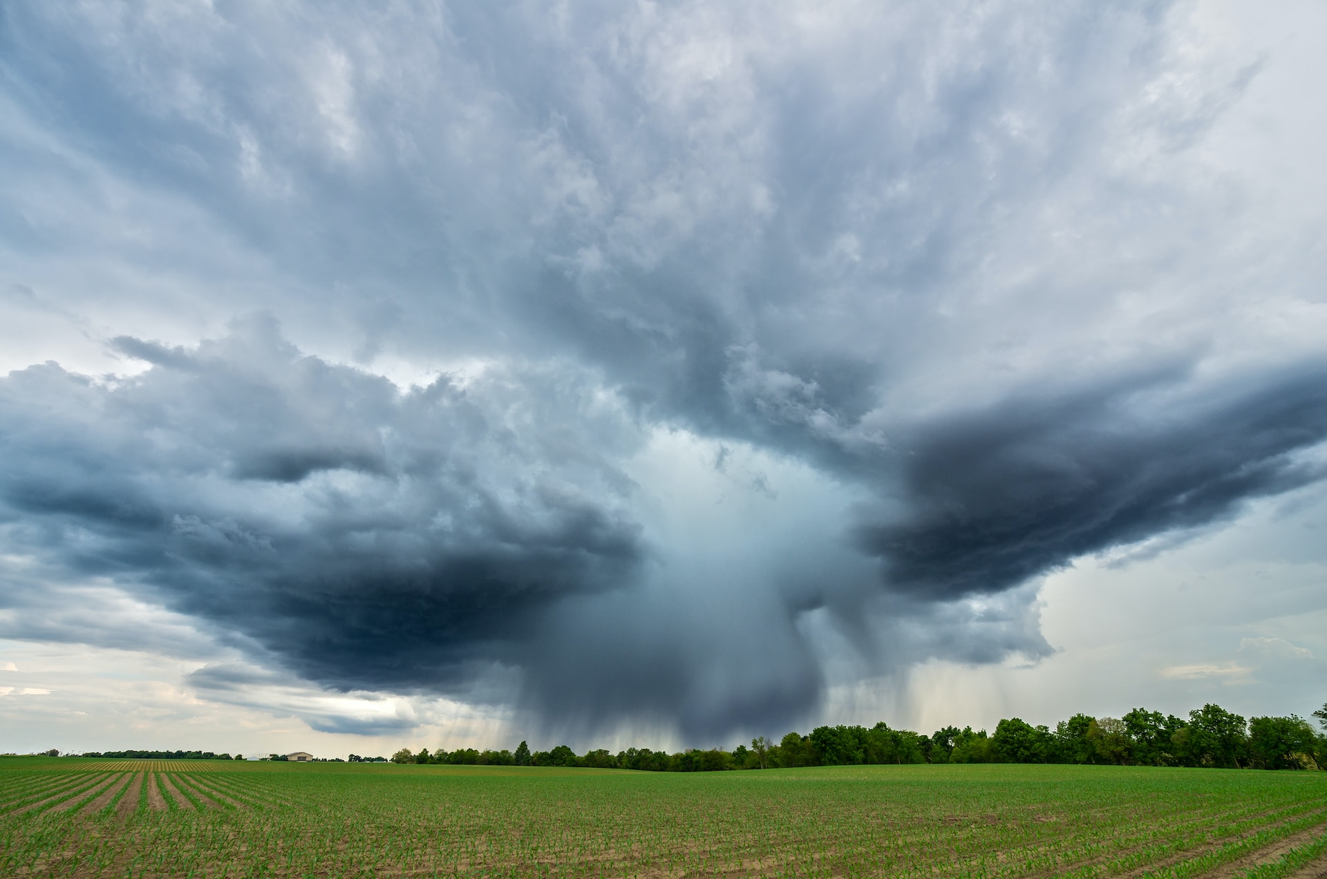
Thunderstorms contain strong upward currents that feed the cloud with water vapor, and downward currents that pour down rain and hail. In some cases, the upward currents can get too strong and lift a lot of water vapor, rain and ice. When they cannot hold it anymore, all this pack falls down to the surface in what is known as a “microburst”.
Microbursts are sudden, short-lived, and extremely dangerous for anything below them: people, houses, planes, etc. The air speed can reach up to 160 km/h. Since they develop at low levels, any plane close to the ground can be pushed down with high risk of impact. This is why airports will cancel all operations when large thunderstorm clouds develop right over them. It's just too risky!
If the push-down wasn't enough, the flow impinging n the surface creates a toroidal vortex with very strong turbulence. So even the surroundings of the microburst are dangerous for planes.
Predicting low-level turbulence
Predicting low-level turbulence requires a fine vertical resolution in numerical weather models. For example, if the resolution of the model is 1 km in the vertical direction, structures smaller than about half that value will not be captured.
The current resolution of the NOAA's global model is 500 m. This might allow capturing thick inversion layers and large thermal plumes, but it is not capable of capturing all of them. Moreover, its horizontal resolution of 13 km is far too large to capture plumes of a few hundred meters in diameter, or microbursts that are even more narrow.
Since these structures cannot be captured, their effect is modeled with sub-models that induce a similar diffusion than the one caused by the upwards and downward currents. This improves the weather prediction, but is not very useful for predicting turbulence.
The advancing computational capacity might allow capturing thermal plumes and inversion layers at some point, but microbursts almost certainty continue to be too short lived and small to be predicted (like predicting lightning).
The aviation industry is well aware that their weather reporting systems can be missing low-level turbulence information, so they rely on Skew-T diagrams and other risk indicators rather than accurate forecasts. This might be the topic for another post.