


El Niño. Flight Turbulence. But Where?
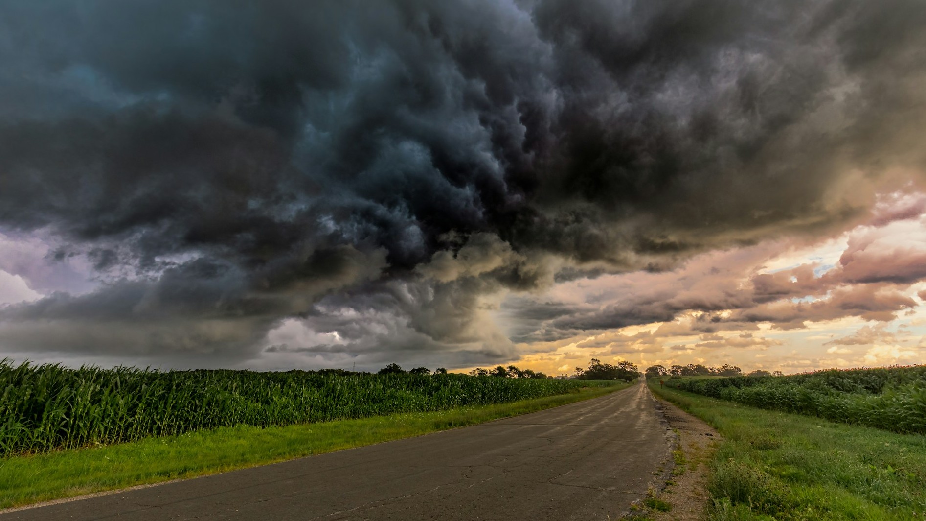
This season's El Niño is expected to be record-breaking. Bad news for aviation, since El Niño tends to produce more turbulence from thunderstorms and jet stream activity. But are all regions in the world equally affected? Let's first understand what El Niño is all about, and then find out.
Sea Surface Temperatures (SST)
The Pacific Ocean, like the Atlantic, has a clockwise circulation in the Northern Hemisphere, and counterclockwise in the South. This direction is induced by the Earth's rotation and by the so-called trade winds: surface winds that blow from east to west over the tropics and merge at the Equator. In a normal year, trade winds generate a strong current from Peru's coast towards Indonesia, resulting in hotter water in Indonesia due to the long time it has travelled along the Equator, picking up heat.
El Niño years are a result of much weaker trade winds. Or even short-lived trade winds blowing in the opposite direction. If that happens, the air can no longer push as much water towards Indonesia, resulting in a higher than usual heating of the eastern Pacific. This higher temperature is known as a Sea Surface Temperature (SST) anomaly, which can be up to +5C for the entire South American coast.
A powerful 2026/27 season
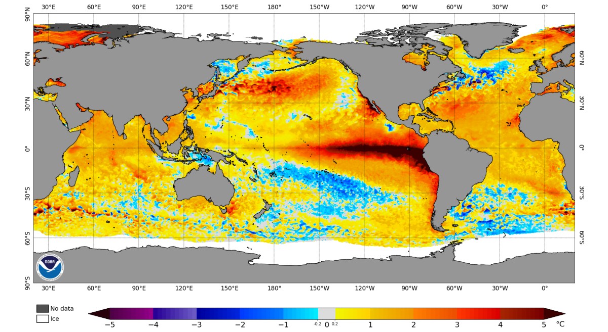
El Niño cycles tend to start around May and peak in January, returning to neutral conditions after 9-12 months. So far, this El Niño is reaching the highest-ever sea surface temperature anomalies since recordings began in 1949. The strong El Niño seasons from 2015/16 and 1997/98 seem small compared to this one.
However, there is a catch in all this. Due to climate change, ocean temperatures have been increasing, so we can’t really compare today’s temperature anomalies to those from 20 years back using the same reference temperature. A more suitable, less spoken-of parameter is the Relative Oceanic Niño Index (RONI), adjusted to climate change. When using this metric, this season’s El Niño is practically on par with the one from 1997/98.
What happened in 1997/98? The report from NOAA describes historic flooding over California, severe tornado outbreaks over Florida, and a strong subtropical jet extending all the way into the Atlantic. On the bright side, India, traditionally affected by severe droughts during El Niño, experienced a perfectly normal season in terms or rain. This was due to a fortunate countering effect from the so called positive Indian Ocean Dipole.
Ocean-atmosphere coupling
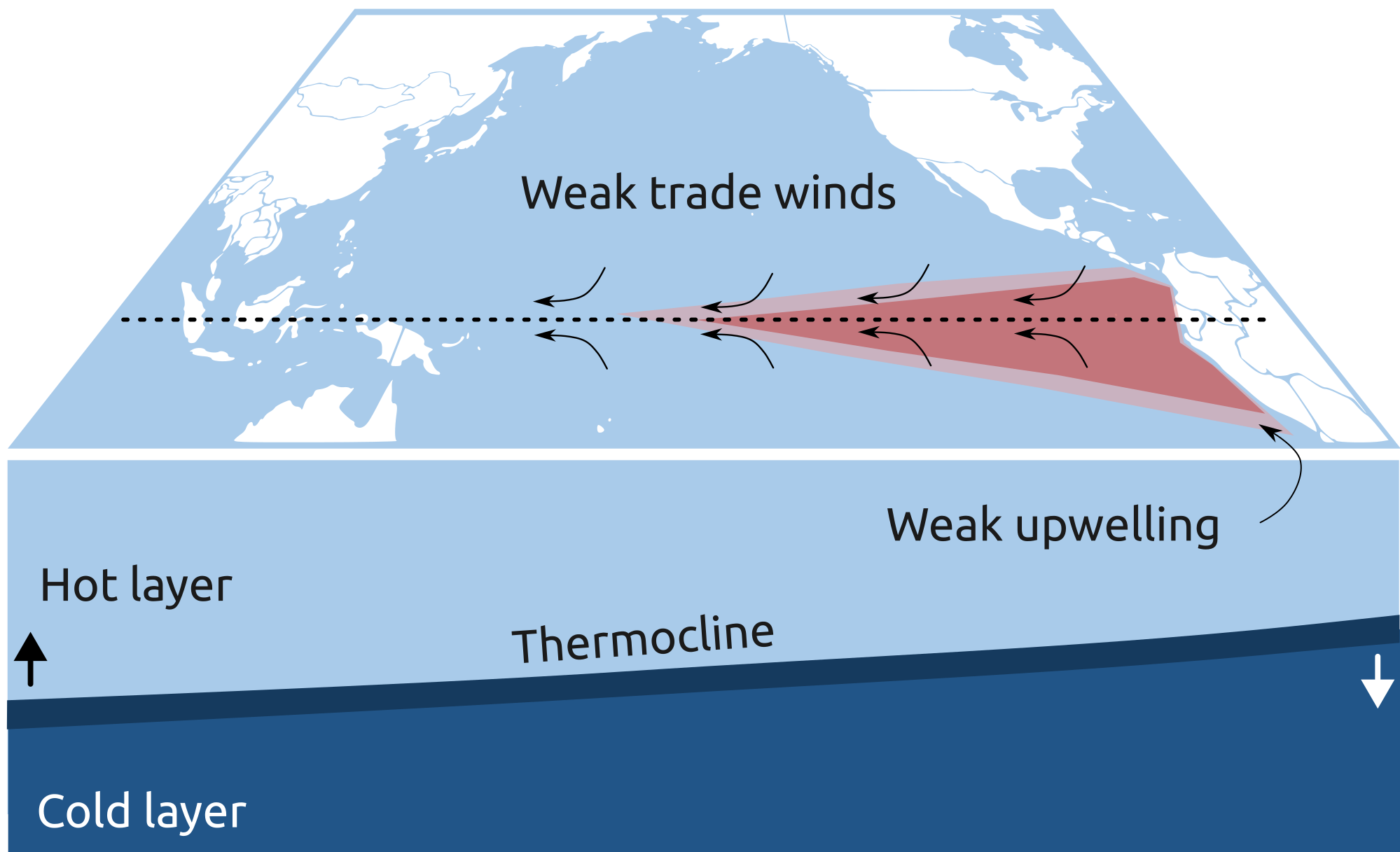
A second side effect from the weaker trade winds is the change in the Pacific's thermocline. The thermocline is the interface between the hot and cold layers of the ocean, with the hot one sitting on top, and the cold one below. The temperature drop at this interface is so large that they can almost be regarded as two independent layers that seldom mix, like vinegar and oil would do if placed in the same container. Thermoclines also develop in lakes, and in fact, there are many lakes around the world whose cold water at the bottom hasn't been exposed to the exterior for thousands of years, making it a precious resource for analysis for geologists (one example is Lake Tanganyika in Africa).
In the Pacific, the thermocline is pushed to lower depths as the water flows from South America to Indonesia. But when El Niño happens, the hot water bubble expands in South America, pushing the thermocline to lower depths over this region and lifting it up over Indonesia. This sudden change in the thermocline is like a ripple that generates the same waves and reflections that you might see when mildly shaking a glass with oil and vinegar. It's just that they are much slower, taking months or years to travel from the South American shore to Indonesia (Kelvin and Rossby waves). But as they reflect, they start working against El Niño, and eventually revert it to neutral or La Niña.
The thermocline's displacement also affects the trade winds, closing a feedback loop that constantly oscillates between El Niño - Neutral - La Niña. Hence the name El Niño Southern Oscillation (ENSO).
Jet stream turbulence
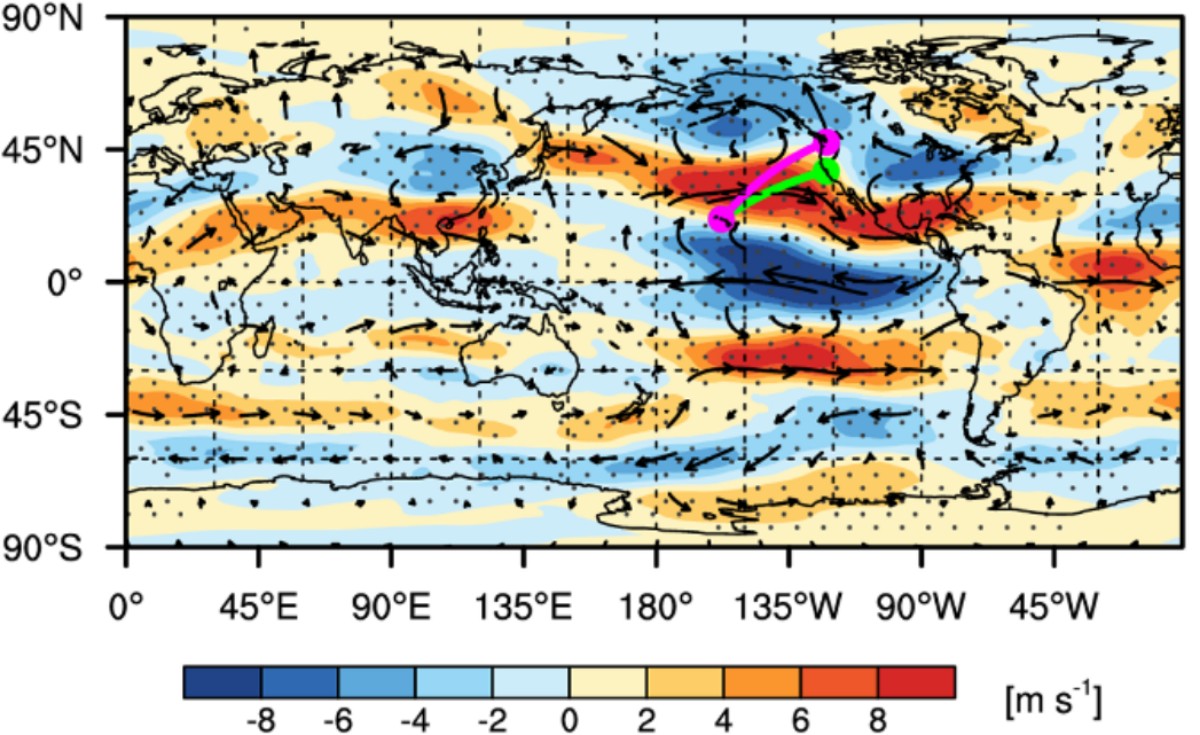
Jet streams are high-speed air streams circling west-to-east around the world. There are two main jets in each hemisphere: the subtropical jet, located at latitudes of Florida, and the polar jet, at around central Canada. The subtropical jet is convection-driven, meaning that it is fueled by the masses of hot air lifted over the Equator. The Polar jet is baroclinic, or pressure-driven, meaning it’s just a result of having a taller tower of hotter air sending flow towards the colder and shorter air masses over the poles.
During El Niño, the hotter water temperatures over South America's shore generate more hot rising air, resulting in a stronger subtropical jet moving roughly between Hawaii and San Francisco towards Mexico and then Miami. A strong subtropical jet increases vertical wind shear, since the jet's core moves faster relative to the air below. Therefore, we can expect higher turbulence over this belt during El Niño cycles.
But what happens over areas away from this stronger subtropical jet, such as Europe and the Northern US? This is actually difficult to predict. As El Niño displaces the subtropical jet closer to the Equator, areas of the North Atlantic that were prone to turbulence are left with calmer conditions than before. This applies to most busy routes such as the famous London to New York route. However, as we move deeper into winter, usually between January and March, the stronger subtropical jet can ripple over the stratosphere and send waves of heat towards it, inducing what is known as Sudden Stratospheric Warming (SSW).
SSW is actually quite normal; it happens often as the jet stream moves. It's just that it happens much more often during El Niño. This increases the chances of sending too much heat to the poles, slowing down the polar jet stream and allowing it to fluctuate more. In some cases, these fluctuations can get locked, splitting the polar jet into two streams around Greenland. If this happens, the lower branch of the polar jet will interact more with the accelerated subtropical jet and result in more turbulence.
Since the polar jet is a wall protecting lower latitudes from cold polar air, European cities expect a similar development of temperature as they do for turbulence. A typical season until December, and a potentially much cooler than average past it if the Greenland blocking gets stuck.
Thunderstorm turbulence
A warmer ocean surface is the first ingredient for more thunderstorm activity, and therefore more turbulence. But it's not the only ingredient!
Before exploring this, it's important to note that El Niño is not just redistributing the ocean's surface temperature. The entire Pacific Ocean becomes hotter, as well as the Indian and North Atlantic. This happens because, when trade winds blow close to South America's shore, they actually pull cold water deep below the surface. This is known as “upwelling”, and it occurs when winds drag surface water away from the coast, where the only way to get more water flowing is by pulling it up from below. During El Niño, trade winds are weaker and therefore pull less cold water from below, resulting in a global increase in sea surface temperatures. The opposite occurs during high trade winds with La Niña.
Due to the high sea surface temperatures (allowing high evaporation rates), the 2026 hurricane season has been remarkably active in the Pacific, with already 11 hurricanes over Category 3 as of 1st November. The average is 4.3. The North Atlantic is also warmer, but it followed the expected textbook behavior: with high vertical wind shear from the subtropical jet (we'll get to that soon), developing storms were quickly dissipated by the shear. Just 1 hurricane over Category 3, a historical low. The average is 3.2.
For aviation, this means that, as we have already seen, the Eastern Pacific has turned into a giant generator of thunderstorm activity, greatly increasing the chances of turbulence for any plane flying around the tall cumulonimbus clouds. However, for the North Atlantic, this summer's thunderstorm activity has been well below average, resulting in less turbulent flying conditions.
Summary
Everything is set for a very strong El Niño 2026/27 season. This will almost certainly increase turbulence over the eastern Pacific, Mexico, and southern US, but it's yet to be seen how much the North Atlantic and Europe will develop. A few more months will tell!