Atmospheric Turbulence: Mountain Waves
Back in 1928, the German glider institute released a weather balloon to study the strong upwards currents reported by some of their gliders. They soon had the first indications of mountain waves. A great attraction for gliders, since it enabled them to reach very high altitudes in a short time. For the aviation industry, the news were not so great.
In one of our previous articles we presented a new US turbulence map, where we saw that the regions with highest turbulence were beside major mountains. Mountain waves can indeed be a big source of turbulence. In this article we will explore how they are formed and where they are usually found.
The recipe for mountain waves
Mountains act as a giant barrier for air flows. The side of the mountain facing the air is usually not very turbulent. There is just not much room for it. The air is pressed against the mountain, rises fast and reaches the peak.
It’s on the back side where things can get shaky…
And I say “can”, because in some cases there might not be much turbulence generated. The recipe to generate mountain waves is as follows:
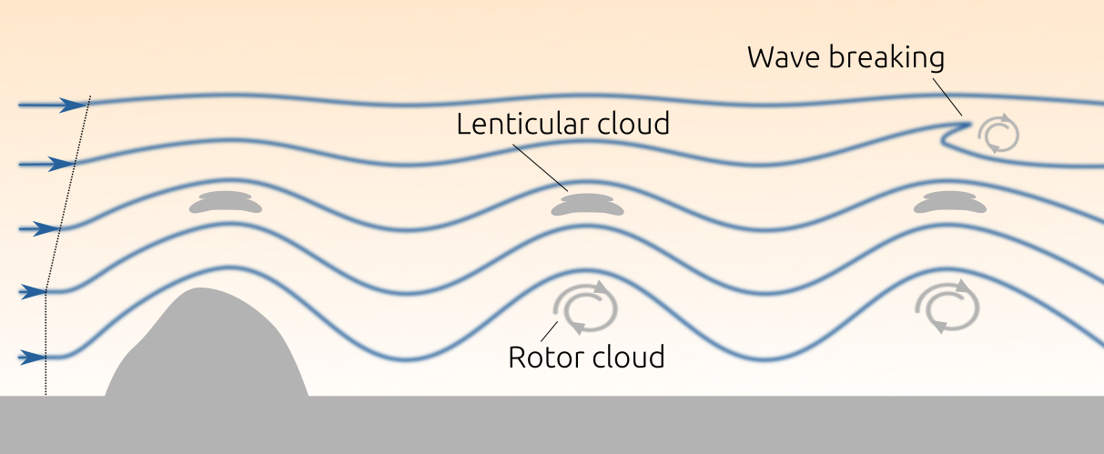
(1) Wind direction: as perpendicular to the mountain as possible. Air flowing with angles of 30 degrees or more will tend to go more parallel to the mountain.
(2) Wind speed near the mountain: it needs to be relatively high, 35 km/h (20 knots) or more. If the wind speed is lower, the air will go smoothly up and down hill, with little chances of generating waves or turbulence.
(3) Wind speed well above the mountain: the speed here needs to increase gradually with the altitude. This will press the air towards the surface, but at the same time allow it to oscillate up and down with little resistance.
Once these conditions are met, the air going down hill will reach the denser air from below and experience an upwards buoyancy force. It will raise again, reach low density air, be pushed down again by buoyancy, and so forth.
The wave is basically the pattern that air needs to follow in order to go back to it's previously stable position, between air layers at different temperatures and pressures. These patterns are not specific to mountain waves. They can be found in many other fluid conditions, and they go with the name of Brunt–Väisälä frequencies.
Bigger waves than what you think
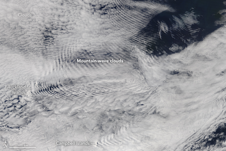
The wavelength, or distance between wave peaks, has been observed to reach up to 300 km. The vertical span of the whole wave can also reach up to 30 km. These large waves were measured in the Antarctic peninsula, a narrow range of tall mountains with the prefect conditions for mountain waves (and therefore loved by scientists).
But in general the wavelengths are in the order of tens of kilometers, although this varies depending on the wind speed. The larger the wind speed the larger the wavelength.
The waves, not much turbulence
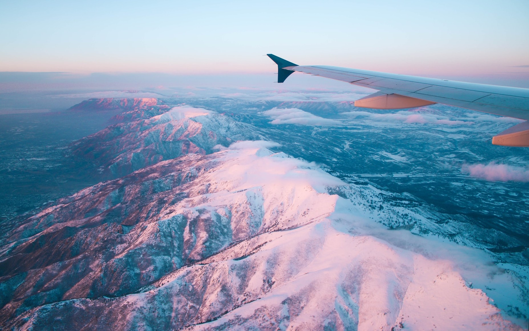
There is not much turbulence in the waves themselves. Pilots have even described it as a region with “extremely smooth flying conditions”.
The main hazard of the waves are their strong downwards currents. These can push the plane dangerously close to the ground, preventing them from re-gaining altitude on time if another mountain is located in front.
Reports of these up/down speeds vary a lot. In Sierra Nevada, US, winds up to 140 km/h have been reported. More usual values tend to be in the range of 20 km/h.
But even if pilots comment on how smooth mountain waves tend to be, they also mention that the change to a turbulent area can be very fast, which brings us to the next section.
Rotors and wave breaking, a lot of turbulence
The rotors are large masses of rotating air caused by the velocity difference between the waves and the ground. Rotor turbulence can reach severe levels, comparable to those of large cumulonimbus storm clouds. Being below the waves, it makes them specially dangerous for planes during the climb and descent.
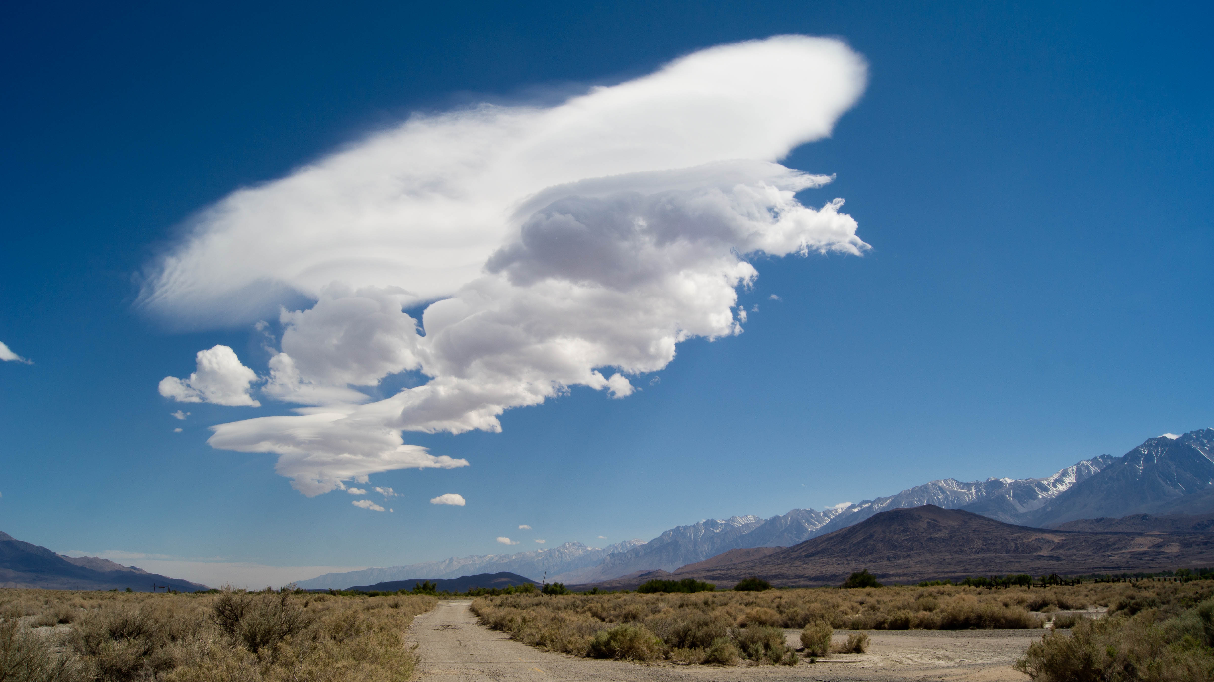
The cruising altitudes are not safe either. Here the waves can become unstable and break at their tip, generating a sudden swirl with high levels of turbulence. Wave breaking can occur well above the mountain, sometimes even reaching the stratosphere (10 - 50 km altitude).
We should also stress that mountain turbulence can also be generated in the absence of waves. This can occur if the air speed well above the mountain is weak, or if the terrain has a large density of mountains which prevents the formation of a long wave pattern.
The Himalayas can be an example of this. Here the long waves found beside the Antarctic peninsula can't form easily since they are immediately disturbed by other mountains. So the pattern would be many scattered turbulent areas with constantly breaking waves and rotors.
Spotting mountain waves
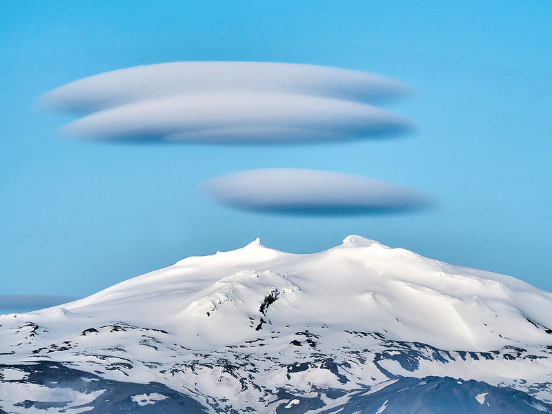
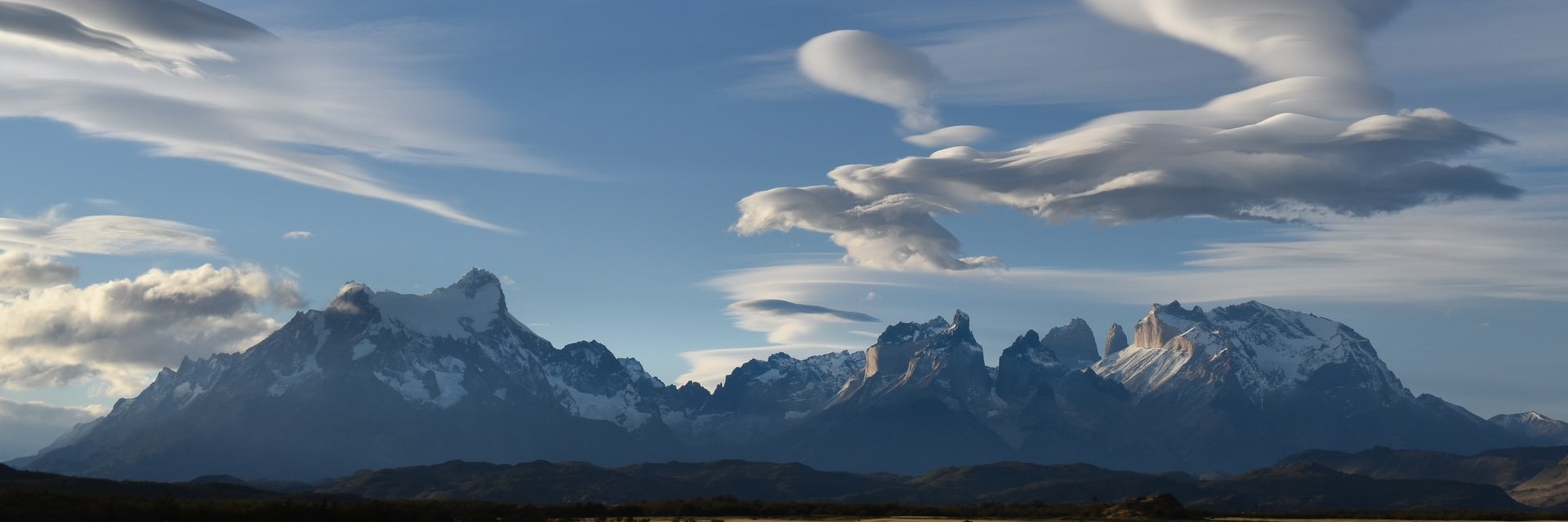
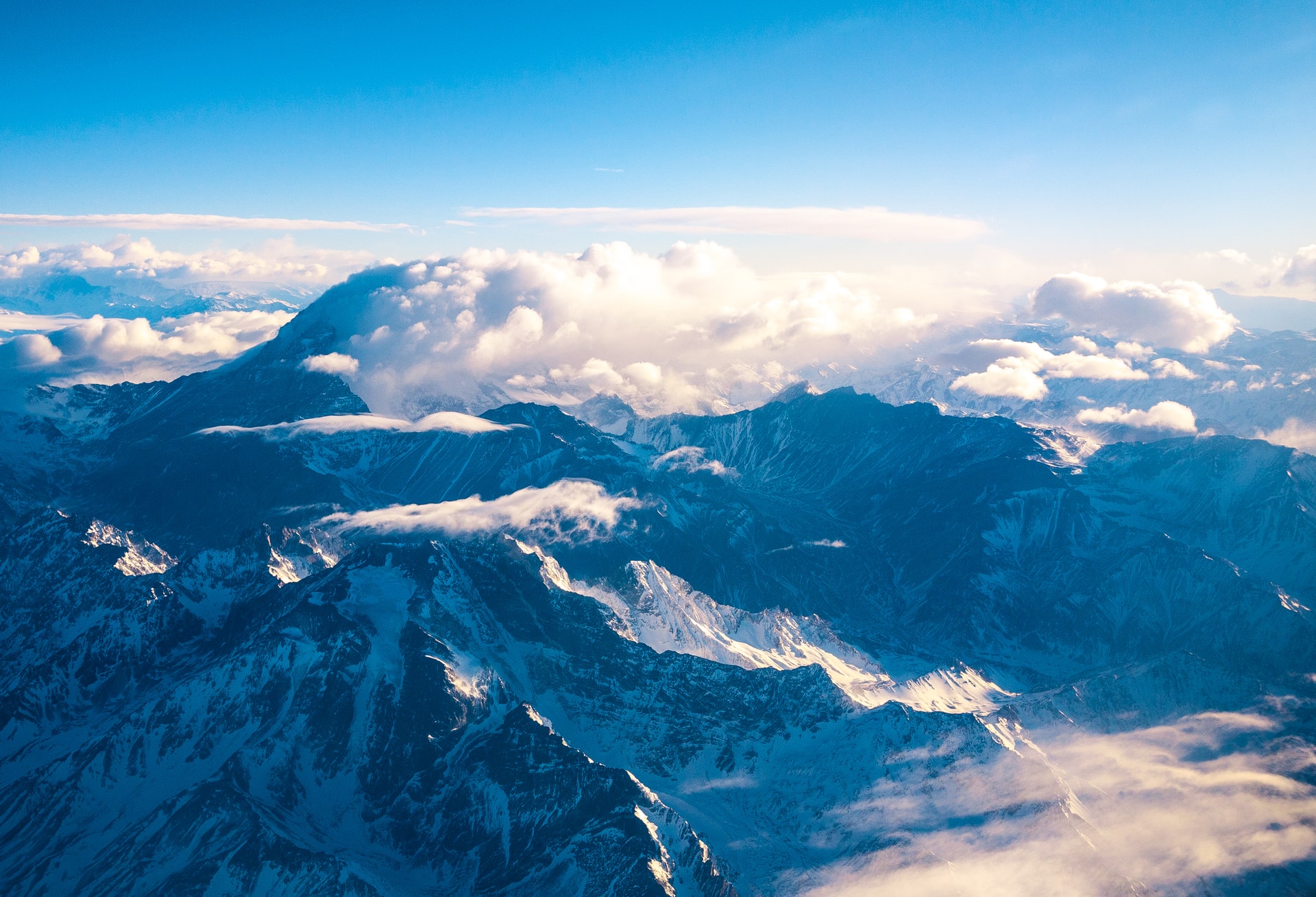
You might have seen mountains with a fluffy looking hat on top of them. These lenticular clouds are a result of hot and moist air which cannot hold its water when reaching the cold temperatures at the mountain top.
As a result, even if the lenticular clouds seem to be static, they are in constant change by receiving and releasing water vapor as the air goes over them.
When a mountain wave is formed, lenticular clouds can appear at the mountain top and at the top of the waves. When spotting such pattern, pilots have a clear warning that mountain waves could be in the zone. If the air is moist enough, the rotors below the wave might also appear as fast rolling clouds, pin-pointing the exact location of the high turbulence area.
Trouble comes when the air is not moist and cannot form clouds to mark the presence of mountain waves. Here pilots need to rely on forecasts and in their own experience.
Forecasting mountain waves
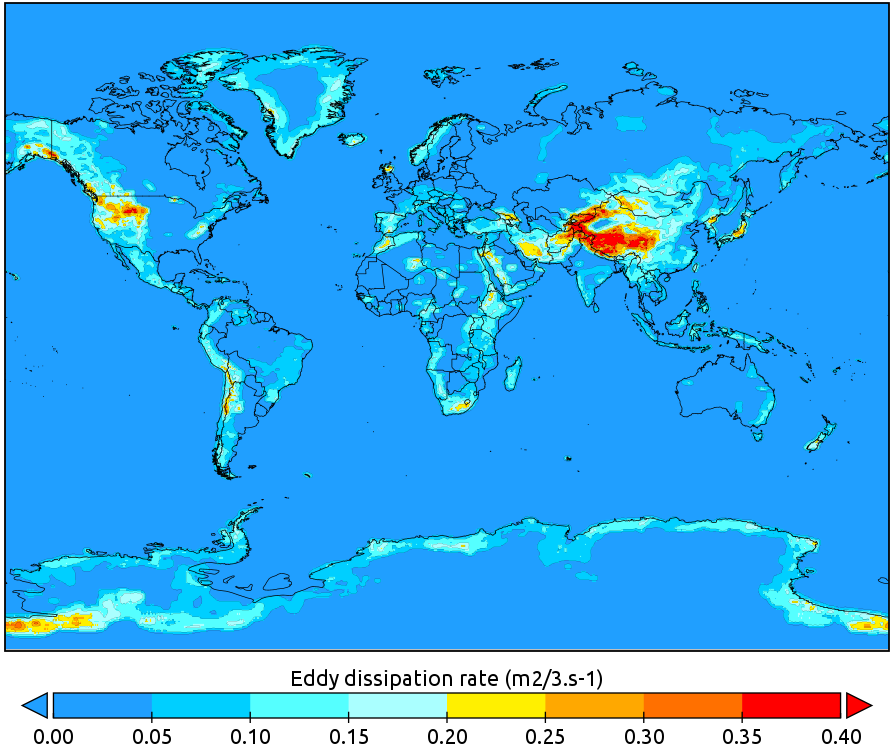
The turbulence forecasts produced by NOAA/NWS are mainly based on the GFS model, which has a spatial resolution of 13 km. This means that they can miss mountain turbulence with scales smaller than 13 km.
To solve this issue, NOAA runs another forecasts in parallel just to predict mountain turbulence with a higher accuracy. The results from both forecasts are then combined, and the highest turbulence from each is given as the "final" forecasted turbulence. This value is what is presented to you in turbli as well.
Comparison with pilot reports has shown that this parallel mountain wave forecast tends to over-predict turbulence. Specially in the light-to-moderate ranges. Over predicting turbulence is much better than under-predicting it, since it means that the data available to pilots will be on the safe side. Still, improvements are on-going to minimize the high rate of false alarms on turbulence, as shown in the following publication.
Where do mountain waves happen?
Most of the data on mountain waves comes from two NASA satellites: the Upper Atmosphere Research Satellite (UARS), active between 1981-2005 and the Atmospheric Infrared Sounder (AIRS) launched in 2002. These satellites had an spatial resolution of 15 and 13.5 km respectively, enabling them to capture many of the mountain wave events.
In the Northern Hemisphere, mountain waves are very common over the US Rockies, Scandinavia, southern Greenland, Queen Elizabeth’s Island and the Eurasian plateau. The strongest activity occurs during winter, since the atmospheric winds are strongest during this season.
Mountain waves have also been observed during the summer in the eastern side of North America. This was a bit unexpected, since summers tend to have much weaker winds. It is attributed to winds picking up speed over the flat surface of the Great Planes, and suddenly hitting the Appalachian mountains to create short waves but with large vertical amplitude.
In the Southern Hemisphere, the strongest mountain turbulence comes from the Andes and from the Antarctic Peninsula. In the Andes the most active region is it's most southern tip, also during the winter season. Some regions in New Zealand also tend to develop waves, but weaker than the previously mentioned.
Gravity waves, from mountains and storms

Gravity waves are a more general term which include waves generated by mountains and the tall cumulonimbus cloud storms.
The physics are similar as in mountains: a stream of air has to climb up and down the cumulonimbus cloud, which can result in a wave pattern on its way down. Since most cumulonimbus clouds are in the tropics, this area has also been identified as a hot-spot for gravity waves and turbulence.
The tropics are in a sense one of the most turbulent regions in the world. They are far from the jet streams, but tall cumulonimbus clouds and gravity waves lead to high chances of turbulence. We might need to cover this region in a separate post.
References
Alexander M.J. and Teitelbaum H., 2007. Observation and analysis of a large amplitude mountain wave event over the Antarctic peninsula. Journal of Geophysical Research, 112, D21103.
Jiang J.H., et al., 2004. A search for mountain waves in MLS stratospheric limb radiances from the winter Northern Hemisphere: Data analysis and global mountain wave modeling. Journal of Geophysical Research, 109, D03107
Plougonven R., Hertzog A., Teitelbaum H., 2008. Observations and simulations of a large-amplitude mountain wave breaking over the Antarctic Peninsula. Journal of Geophysical Research, 113, D16113.
Alaka M.A., 1967. Aviation aspects of mountain waves. World Meteorological Organization, num 68, TP 26.
McLandress C., Alexander M.J., Wu D.L., 2000. Microwave Limb Sounder observations of gravity waves in the stratosphere: a climatology and interpretation. Journal of Geophysical Research, 105, D9, pages 11,947-11,967.
Jiang J.H., et al., 2004. Geographical distribution and interseasonal variability of tropical deep convection: UARS MLS observations and analyses. Journal of Geophysical Research, 109, D03111
Petty M.A., etl al., 2014. Assessment of the Graphical Turbulence Guidance, version 3 (GTG3). NOAA/ESRL/GSD/Forecast Impact and Quality Assessment Section
Kim J.H. et al, 2019. Improvement of Mountain-Wave Turbulence Forecasts in NOAA’s Rapid Refresh (RAP) Model with the Hybrid Vertical Coordinate System. American Meteorological Society, Weather and Forecasting, 773-780.
Jiang J.H. and Wu D.L., 2002. Upper Atmosphere Research Satellite (UARS) MLS observation of mountain waves over the Andes. Journal of Geophysical Research, 107, num D20, 8273.

